
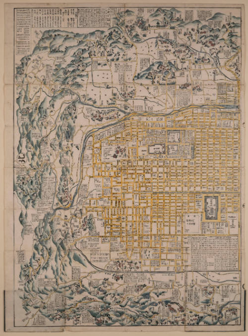

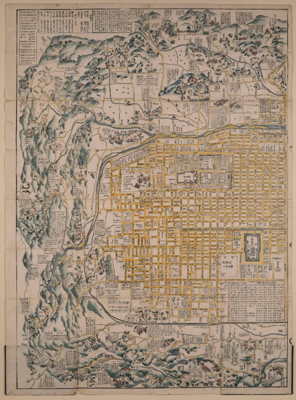
Great Illustrated Map of Kyoto and its Surroundings in a New Edition (増補再版京大繪圖, Zoho Saihan Kyo Oezu)
This part of the map is Kitayama yori Minami-Sanjo made (From Kitayama to south of Sanjo)
Maker
Hayashi Yoshinaga (林吉永)
(Japanese, active in the 18th century)
Date18th century (originally dated 1741)
MediumWoodblock prints
DimensionsEach: 53 x 40 in. (134.6 x 101.6 cm)
Framed: 53 1/2 × 40 9/16 × 1 in. (135.9 × 103 × 2.5 cm)
Framed: 53 1/2 × 40 9/16 × 1 in. (135.9 × 103 × 2.5 cm)
Credit LineGift of Goldman Asset Management Inc.
Object number1993.1a
Terms
- Edo (Japanese period)
Object TypePrints
On View
Not on view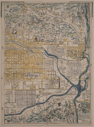
Hayashi Yoshinaga (林吉永)
18th century (originally dated 1741)

Francisco de Goya
1810 - 1820 (plates, published 1863)
Francisco de Goya
1810 - 1820 (plates, published 1863)